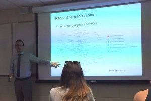
Dr. Olivier Walther gave a lecture on Thursday October 5 for the Department of Geography. His lecture, “Mapping cross-border policy networks in West Africa” discussed his recent research for the Organisation for Economic Co-operation and Development (OECD). Using social network analysis, quantitative indicators,  and mental maps, the project sought to better understand cross-border cooperation in 18 countries throughout West Africa. Analyzing cross-border cooperation requires an understanding of the current situation, potential, and political vision. This leads to identifying unexploited potential, political priorities, and the lack of means, which leads to fully integrated policies, a main goal of the OECD.
Dr. Walther used social network analysis to identify where cross-border cooperation takes place and how actors are connected. Moreover, he looked at embeddedness and brokerage to see if policy makers are densely connected to others or if they bridge groups that would otherwise be disconnected. Regional organizations were examined to ascertain who works with whom in cross-border cooperation, and to identify information brokers in these networks. One of the questions asked in the project was whether policy makers exchange more across borders than within their country. The expectation was that in-country affiliations would be strongest due to homophily. However, results showed that most influential actors involved in designing West African policies are based in Europe, and African actors were in the periphery of networks. This information will pose a challenge for the OECD as it attempts to connect peripheries to strengthen cross-border collaborations.
Dr. Walther used mental maps to determine where cross-border cooperation should take place to inform future OECD investment decisions. These maps identified consensus through average area and density, as well as mean center, standard deviational ellipse, and standard distance. The expectation is that cooperation would be more successful when map areas overlap between policy makers’ mental maps.
Quantitative indicators were used to show where cross-border cooperation could take place in the future. Indicators used included population, water resources, agricultural and pastoral resources, languages, poverty, political stability, and legal status of international borders. Dr. Walther found that the regions with the highest potential for cross-border cooperation in West Africa were the Sahel and Gulf of Guinea.
The presentation concluded that policies should be tailored to a region’s specificities, that we should understand ties and not just attributes, and that a West African model of integration must be developed.
